Retrieval of Faune-France data near a google maps location

Récupération des données de Faune-France près d’un lieu google maps. Utilisation de Bottle (https://bottlepy.org/docs/dev/) Tout passe par le WSGIPour Alwaysdata, c’est dans /admin/config/uwsgi chdir = /home/faune/www wsgi-file = /home/faune/www/wsgi.py L installation est: make install_alwaysdata Sinon faire: Pour l’installation: $ git clone [email protected]:g-normand/faune_proche.git $ cd faune_proche $ make install GitHub View Github    

Read more
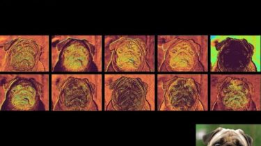
Makes viewing feature maps a breeze with python

Convolutional Neural Networks Are Beautiful We all take our eyes for granted, we glance at an object for an instant and our brains can identify with ease. However distorted the information may be, we do a pretty good job at it. Low light, obscured vision, poor eyesight… There are a myriad of situations where conditions are poor but still we manage to understand what an object is. Context helps, but we humans were created with sight in mind. Computers have […]

Read more

A minimal Python library to draw customized maps from OpenStreetMap data

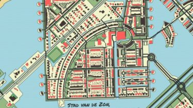
prettymaps A minimal Python library to draw customized maps from OpenStreetMap data. Based on osmnx, matplotlib, shapely and vsketch libraries. Google Colaboratory Demo Installation Install with $ pip install git+https://github.com/abey79/vsketch#egg=vsketch $ pip install git+https://github.com/marceloprates/prettymaps.git # Init matplotlib figure fig, ax = plt.subplots(figsize = (12, 12), constrained_layout = True) backup = plot( # Address: ‘Praça Ferreira do Amaral, Macau’, # Plot geometries in a circle of radius: radius = 1100, # Matplotlib axis ax = ax, # Which OpenStreetMap layers to […]

Read more

Create Interactive maps with your geodataframe

geopatra Geopatra extends geopandas for interactive mapping and attempts to wrap the goodness of amazing mapping libraries like Folium, Plotly, Kepler.gl, hvplot etc for rapidly creating interactive maps with Geodataframes You can already create interactive maps easily with geopandas and Folium/ Plotly/ Kepler.gl. Geopatra is merely meant to make this easier and is more geared towards ease and currently does not support complex maps or intricate style control Installation Everything is always a pip away pip install geopatra Basic Usage […]

Read more

Manage your XYZ Hub or HERE Data Hub spaces from Python

XYZ Spaces for Python Manage your XYZ Hub or HERE Data Hub spaces from Python. Motivation XYZ is an Open Source, real-time, cloud database system providing access to large geospatial data at scale. An XYZ “Hub” manages “spaces” that contain “features” (geodata “records”) with tags and properties, with spaces and features having unique IDs. A RESTful API exists to provide low-level access to interact with a XYZ Hub. This Python package allows to interact with your XYZ spaces and features […]

Read more

A Google Maps Tool Collects What’s Available For A User-specified Region In The Form Of A GIF

google-maps-at-88-mph The folks maintaining Google Maps regularly update the satellite imagery it serves its users, but outdated versions of the imagery are kept around in for a year or two. This Python-based tool automatically crawls its way through these versions, figuring out which provide unique imagery and downloading it for a user-defined (that’s you! you get to define things!) area, eventually assembling it in the form of a GIF. This weekend project is based on ærialbot, a previous weekend project […]

Read more

An OpenStreetMap downloader written in Python

GetOSM GetOSM is an OpenStreetMap downloader written in Python that is agnostic of GUI frameworks. It is used with tkinter by ProjPicker. GetOSM is an OpenStreetMap downloader written in Python that is agnostic ofGUI frameworks. It is used withtkinter byProjPicker. Requirements GetOSM uses the following standard modules: Demo GUIs osmtk: tkinter demo osmwx: wxPython demo Only map viewing is implemented. GitHub https://github.com/HuidaeCho/getosm    

Read more

A Python module that allows the user to select all coordinate reference systems

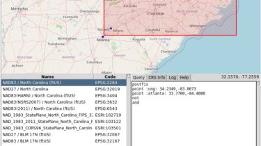
ProjPicker ProjPicker (projection picker) is a Python module that allows the user to select all coordinate reference systems (CRSs) whose extent completely contains given points, polylines, polygons, and bounding boxes using set-theoretic logical operators in a postfix notation. The goal is to make it easy and visual to select a desired projection by location. This project was motivated by a GRASS GIS feature request. A new GRASS GIS module g.projpicker that wraps around this project is available. It is a […]

Read more

A ninja Python package behind rgee, rgeeExtra and eemont

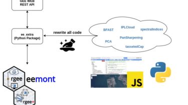
A ninja Python package behind rgee, rgeeExtra and eemont. Google Earth Engine is a cloud-based service for geospatial processing of vector and raster data. The Earth Engine platform has a JavaScript and a Python API with different methods to process geospatial objects. Google Earth Engine also provides a HUGE PETABYTE-SCALE CATALOG of raster and vector data that users can process online (e.g. Landsat Missions Image Collections, Sentinel Missions Image Collections, MODIS Products Image Collections, World Database of Protected Areas, etc.). […]

Read more

Streamlit Component for rendering kepler.gl maps

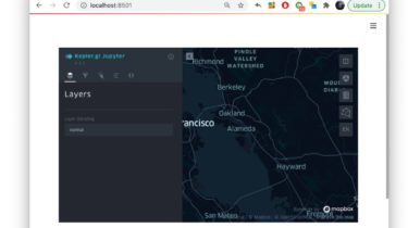
streamlit-keplergl Streamlit Component for rendering kepler.gl maps in a streamlit app. Installation pip install streamlit-keplergl How to use it import streamlit as st from streamlit_keplergl import keplergl_static from keplergl import KeplerGl st.write(“This is a kepler.gl map in streamlit”) map_1 = KeplerGl(height=400) keplergl_static(map_1) Options fig: keplergl.KeplerGl map figure. height: Height of result. If height is set on the keplergl.KeplerGl object, that value supersedes the values set with the keyword arguments of this function. width: Width of result. GitHub https://github.com/chrieke/streamlit-keplergl    

Read more
1 2