A Python package for geospatial analysis and interactive mapping

leafmap
A Python package for geospatial analysis and interactive mapping in a Jupyter environment.
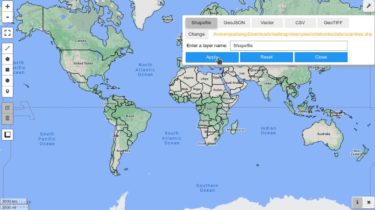
leafmap is a Python package for geospatial analysis and interactive mapping in a Jupyter environment. It is a spin-off project of the geemap Python package, which was designed specifically to work with Google Earth Engine (GEE). However, not everyone in the geospatial community has a GEE account. leafmap is designed to fill this gap for non-GEE users. It enables users to perform advanced geospatial analysis and interactive mapping with minimal coding in a Jupyter environment (e.g., Google Colab, JupyterLab, Jupyter notebook). It is built upon a number of open-source packages, such as folium and ipyleaflet (for creating interactive maps), WhiteboxTools and whiteboxgui (for analyzing geospatial data), and ipywidgets (for designing interactive graphical