ArcGIS Python Toolbox for WhiteboxTools

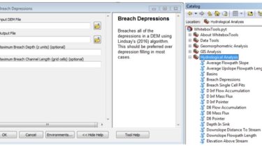
ArcGIS Python Toolbox for WhiteboxTools. This repository is related to the ArcGIS Python Toolbox for WhiteboxTools, which is an ArcGIS frontend of a stand-alone executable command-line program called WhiteboxTools. WhiteboxTools-ArcGIS is an ArcGIS Python Toolbox for WhiteboxTools, an advanced geospatial data analysis platform developed by Prof. John Lindsay (webpage; jblindsay) at the University of Guelph’s Geomorphometry and Hydrogeomatics Research Group. WhiteboxTools can be used to perform common geographical information systems (GIS) analysis operations, such as cost-distance analysis, distance buffering, and […]

Read more

Get Landsat surface reflectance time-series from google earth engine

Google Earth Engine data extraction tool. Quickly obtain Landsat multispectral time-series for exploratory analysis and algorithm testing Online documentation available at https://loicdtx.github.io/landsat-extract-gee A python library (API + command lines) to extract Landsat time-series from the Google Earth Engine platform. Can query single pixels or spatially aggregated values over polygons. When used via the command line, extracted time-series are written to a sqlite database. The idea is to provide quick access to Landsat time-series for exploratory analysis or algorithm testing. Instead […]

Read more

A C/Python library with vectorized geometry functions

PyGEOS PyGEOS is a C/Python library with vectorized geometry functions. The geometry operations are done in the open-source geometry library GEOS. PyGEOS wraps these operations in NumPy ufuncs providing a performance improvement when operating on arrays of geometries. Note: PyGEOS is a very young package. While the available functionality should be stable and working correctly, it’s still possible that APIs change in upcoming releases. But we would love for you to try it out, give feedback or contribute! What is […]

Read more

Create Interactive maps with your geodataframe

geopatra Geopatra extends geopandas for interactive mapping and attempts to wrap the goodness of amazing mapping libraries like Folium, Plotly, Kepler.gl, hvplot etc for rapidly creating interactive maps with Geodataframes You can already create interactive maps easily with geopandas and Folium/ Plotly/ Kepler.gl. Geopatra is merely meant to make this easier and is more geared towards ease and currently does not support complex maps or intricate style control Installation Everything is always a pip away pip install geopatra Basic Usage […]

Read more

Python bindings to libpostal for fast international address parsing/normalization

pypostal These are the official Python bindings to https://github.com/openvenues/libpostal, a fast statistical parser/normalizer for street addresses anywhere in the world. Usage from postal.expand import expand_address expand_address(‘Quatre vingt douze Ave des Champs-Élysées’) from postal.parser import parse_address parse_address(‘The Book Club 100-106 Leonard St, Shoreditch, London, Greater London, EC2A 4RH, United Kingdom’) Installation Before using the Python bindings, you must install the libpostal C library. Make sure you have the following prerequisites: On Ubuntu/Debian sudo apt-get install curl autoconf automake libtool python-dev pkg-config […]

Read more

Python module to access the OpenCage geocoding API

OpenCage Geocoding Module for Python A Python module to access the OpenCage Geocoder. Usage Supports Python 3.6 or newer. Use the older opencage 1.x releases if you need Python 2.7 support. Install the module: pip install opencage Load the module: from opencage.geocoder import OpenCageGeocode Create an instance of the geocoder module, passing a valid OpenCage Data Geocoder API keyas a parameter to the geocoder modules’s constructor: key = ‘your-api-key-here’ geocoder = OpenCageGeocode(key) Pass a string containing the query or address […]

Read more

User friendly Rasterio plugin to read raster datasets

rio-tiler User friendly Rasterio plugin to read raster datasets. rio-tiler was initialy designed to create slippy maptiles from large raster datasources and render these tiles dynamically on a web map. With rio-tiler v2.0 we added many more helper methods to readdata and metadata from any raster source supported by Rasterio/GDAL.This includes local files and via HTTP, AWS S3, Google Cloud Storage,etc. At the low level, rio-tiler is just a wrapper around the rasterio.vrt.WarpedVRT class, which can be useful for doing […]

Read more

Cloud Optimized GeoTIFF creation and validation plugin for rasterio

rio-cogeo Cloud Optimized GeoTIFF (COG) creation and validation plugin for Rasterio. Cloud Optimized GeoTIFF This plugin aims to facilitate the creation and validation of Cloud OptimizedGeoTIFF (COG or COGEO). While it respects theCOG specifications, this plugin alsoenforces several features: Internal overviews (User can remove overview with option –overview-level 0) Internal tiles (default profiles have 512×512 internal tiles) Important: in GDAL 3.1 a new COG driver has been added (doc, discussion), starting with rio-cogeo version 2.2, –use-cog-driver option was added to […]

Read more

A Python library for image processing of geospatial raster data

GIPPY Gippy is a Python library for image processing of geospatial raster data. The core of the library is implemented as a C++ library, libgip, with Python bindings automatically generated with swig. Gippy encapsulates the functionality of GDAL and CImg that automatically handles issues common to geospatial data, such as handling of nodata values and chunking up of very large images by saving chains of functions and only processing the image in pieces upon a read request. In addition to […]

Read more

Python 3-D geographic coordinate conversions and geodesy

Python 3-D coordinate conversions Pure Python (no prerequistes beyond Python itself) 3-D geographic coordinate conversions and geodesy. API similar to popular $1000 Matlab Mapping Toolbox routines for Python PyMap3D is intended for non-interactive use on massively parallel (HPC) and embedded systems. Prerequisites Pymap3d is compatible with Python ≥ 3.7 including PyPy.Numpy and AstroPy are optional; algorithms from Vallado and Meeus are used if AstroPy is not present. Install python3 -m pip install pymap3d or for the latest development code: git […]

Read more
1 22 23 24 25 26 51