Python package for performing Entity and Text Matching using Deep Learning
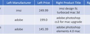
DeepMatcher is a Python package for performing entity and text matching using deep learning. It provides built-in neural networks and utilities that enable you to train and apply state-of-the-art deep learning models for entity matching in less than 10 lines of code. The models are also easily customizable – the modular design allows any subcomponent to be altered or swapped out for a custom implementation. As an example, given labeled tuple pairs such as the following: DeepMatcher uses labeled tuple […]
Read more