A simple scheduler tool that provides desktop notifications about classes

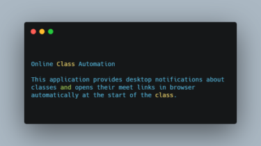
Online Class Automation This application provides desktop notifications about classes and opens their meet links in browser automatically at the start of the class. It works both in windows and linux. But runs better in linux when used with cron. Code Overview class-data.json: Stores the timetable in simple json format. Specify the name and meet link of classes with their timings according to your timetable. The time of a class is specified by day and hour. Day ranges from 0 […]

Read more

An Exploration of JSON Interoperability Vulnerabilities

JSON Interoperability Vulnerability Labs These are the companion labs to my research article “An Exploration of JSON Interoperability Vulnerabilities”. Lab 1: Free purchases in an E-commerce Application Key Collision Attacks: Inconsistent Duplicate Key Precedence Inconsistent Large Number Representations Lab 2: Privilege Escalation in a Multi-tenant Application Key Collision Attacks: Character Truncation These labs bind to host ports 5000-5004, by default. Attack Techniques 1. Key Collisions Inconsistent Duplicate Key Precedence {“qty”: 1, “qty”: -1} Character Truncation Truncation in last-key precedence parsers […]

Read more

A collection of fancy functional tools focused on practicality

A collection of fancy functional tools focused on practicality. Inspired by clojure, underscore and my own abstractions. Keep reading to get an overview or read the docs. Or jump directly to cheatsheet. Works with Python 2.7, 3.4+ and pypy. Installation pip install funcy Overview Import stuff from funcy to make things happen: from funcy import whatever, you, need Merge collections of same type (works for dicts, sets, lists, tuples, iterators and even strings): merge(coll1, coll2, coll3, …) join(colls) merge_with(sum, dict1, […]

Read more

An embedded application for toy-car controlling based on Raspberry Pi 3

PiCar An embedded application for toy-car controlling based on Raspberry Pi 3 Model B and AlphaBot2-Pi. This is the source codes of my programming assignment of the course Embedded Applications on Intelligent Systems (2020 Fall) at NJU. Features Motor Going foreward or backward Turning left or right Infrared remote control Obstacle avoidance Self tracing Real-time camera Monitor and control by web Usage python -m picar There is a demo which uses a fake car implement. It is fully Python codes, […]

Read more

DeepSpeed powers 8x larger MoE model training with high performance

Today, we are proud to announce DeepSpeed MoE, a high-performance system that supports massive scale mixture of experts (MoE) models as part of the DeepSpeed optimization library. MoE models are an emerging class of sparsely activated models that have sublinear compute costs with respect to their parameters. For example, the Switch Transformer consists of 1.6 trillion parameters, while the compute required to train it is approximately equal to that of a 10 billion-parameter dense model. This increase in model size […]

Read more

A Python Framework for Large-Scale SAR Satellite Data Processing

pyroSAR A Python Framework for Large-Scale SAR Satellite Data Processing. The pyroSAR package aims at providing a complete solution for the scalable organization and processing of SAR satellite data: Reading of data from various past and present satellite missions Handling of acquisition metadata User-friendly access to processing utilities in SNAP and GAMMA Remote Sensing software Formatting of the preprocessed data for further analysis Export to Data Cube solutions Head on over to readthedocs for installation instructions, examples and API reference. […]

Read more

Scalable analysis of image and time series analysis in python

thunder Thunder is an ecosystem of tools for the analysis of image and time series data in Python. It provides data structures and algorithms for loading, processing, and analyzing these data, and can be useful in a variety of domains, including neuroscience, medical imaging, video processing, and geospatial and climate analysis. It can be used locally, but also supports large-scale analysis through the distributed computing engine spark. All data structures and analyses in Thunder are designed to run identically and […]

Read more

A toolbox for processing earth observation data with Python

eo-box eobox is a Python package with a small collection of tools for working with Remote Sensing / Earth Observation data. Package Overview So far, the following subpackages are available: eobox.sampledata contains small sample data that can be used for playing around and testing. eobox.raster contains raster processing tools for extracting raster values at given (by vector data) locations, window- / chunk-wise processing of multiple single layer rasterfiles that do not fit in memory, e.g. calculating virtual time series and […]

Read more

A Python package for delineating nested surface depressions from digital elevation data

lidar lidar is Python package for delineating the nested hierarchy of surface depressions in digital elevation models (DEMs). It is particularly useful for analyzing high-resolution topographic data, such as DEMs derived from Light Detection and Ranging (LiDAR) data. GitHub repo: https://github.com/giswqs/lidarDocumentation: https://lidar.gishub.orgPyPI: https://pypi.org/project/lidarConda-forge: https://anaconda.org/conda-forge/lidarOpen in Colab: https://gishub.org/lidar-colabFree software: MIT license lidar is a Python package for delineating the nested hierarchy of surface depressions in digital elevation models (DEMs). In traditional hydrological modeling, surface depressions in a DEM are commonly treated […]

Read more

The whitebox Python package is built on WhiteboxTools

whitebox-python The whitebox Python package is built on WhiteboxTools, an advanced geospatial data analysis platform developed by Prof. John Lindsay (webpage; jblindsay) at the University of Guelph’s Geomorphometry and Hydrogeomatics Research Group. WhiteboxTools can be used to perform common geographical information systems (GIS) analysis operations, such as cost-distance analysis, distance buffering, and raster reclassification. Remote sensing and image processing tasks include image enhancement (e.g. panchromatic sharpening, contrast adjustments), image mosaicing, numerous filtering operations, simple classification (k-means), and common image transformations. […]

Read more
1 21 22 23 24 25 51